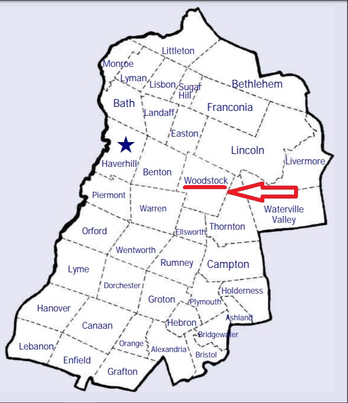


| Burial Sites in Woodstock, New Hampshire |
|---|
| To see a map of all sites click here. |
| W19-001 Jackman, Route 112, USGS Lincoln Quadrangle, E28388, N487878, Zone 19 (44° 1' 56"N, 71° 41' 49"W), Source: Cemetery Directory 1980 MAP See: Find a Grave |
| W19-002 Parker, Route 3, USGS Lincoln Quadrangle, E28483, N487733, Zone 19 (44° 1' 10"N, 71° 41' 4"W), Source: Cemetery Directory 1980 MAP |
| W19-003 Woodstock Cemetery, Route 3, USGS Woodstock Quadrangle, E28481, N487325, Zone 19 (43° 58' 58"N, 71° 40' 59"W), Source: Cemetery Directory 1980 MAP |
Listings Copyright © 1998-2024 New Hampshire Old Graveyard Association.
All rights reserved.
Send mail to webmaster@nhoga.org with questions or comments about this web site.