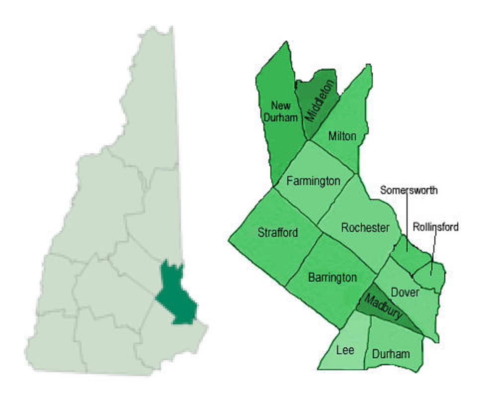


| Burial Sites in Somersworth, New Hampshire |
|---|
| Note: The sites with "red background" do not look correct on the Google maps corresponding to the lat/long coordinates for that cemetery. The problem may be either incorrect lat/long or changed street names. Please send any corrections to NHOGA Webmaster with corrected lat/longs in degrees/minutes/seconds or degrees + fractional degrees to 6 places. |
| To see a map of all sites click here. |
| ------ Aldrich, See: Brown, S11-013 |
| ------ Bean, See: Ricker, S11-003 |
| S11-013 Brown, High Street (Rte. 9), USGS Dover West Quadrangle, E34709, N478843, Zone 19 (43° 14' 6"N, 70° 52' 59"W), Source: Brian Tapscott 1988 MAP |
| ------ Burnham, See: Hanson, S11-015 |
| S11-016 Burnham, Route 16, USGS Rochester Quadrangle, E34495, N479206, Zone 19 (43° 16' 2"N, 70° 54' 38"W), Source: Brian Tapscott 1988 MAP |
| S11-017 Cook, off Route 16, USGS Rochester Quadrangle, E34532, N479041, Zone 19 (43° 15' 9"N, 70° 54' 20"W), Source: Brian Tapscott 1988 MAP |
| S11-018 Cook, Route 16B (Old Rochester Rd.), USGS Rochester Quadrangle, E34410, N479092, Zone 19 (43° 15' 25"N, 70° 55' 14"W), Source: Brian Tapscott 1988 MAP |
| ------ Dow, See: Hanson, S11-015 |
| ------ Downs, See: Morrill, S11-002 |
| S11-004 Fieldstone, uprooted, USGS Dover West Quadrangle, E34760, N478905, Zone 19 (43° 14' 27"N, 70° 52' 37"W), Source: Brian Tapscott 1988 MAP |
| S11-007 Fieldstone, Rocky Hill Road, USGS Rochester Quadrangle, E34746, N479209, Zone 19 (43° 16' 5"N, 70° 52' 47"W), Source: Brian Tapscott 1988 MAP |
| S11-020 Forest Glade, Maple Street, USGS Rochester Quadrangle, E34718, N479033, Zone 19 (43° 15' 8"N, 70° 52' 57"W), Source: Brian Tapscott 1988 MAP |
| S11-023 Greek Cemetery, in Forest Glade, USGS Rochester Quadrangle, E34718, N479033, Zone 19 (43° 15' 8"N, 70° 52' 57"W), Source: Brian Tapscott 1988 MAP |
| ------ Ham, See: Ricker, S11-003 |
| S11-011 Ham, Genest Street, USGS Dover West Quadrangle, E34733, N478808, Zone 19 (43° 13' 55"N, 70° 52' 48"W), Source: Brian Tapscott 1988 MAP |
| S11-015 Hanson, Route 16, USGS Rochester Quadrangle, E34510, N479202, Zone 19 (43° 16' 1"N, 70° 54' 31"W), Source: Brian Tapscott 1988 MAP |
| S11-021 Holy Trinity, High Street, USGS Dover West Quadrangle, E34759, N479000, Zone 19 (43° 14' 58"N, 70° 52' 39"W), Source: Brian Tapscott 1988 MAP |
| ------ Horne, See: Cook, S11-017 |
| S11-001 Hurd, Indigo Hill Road, USGS Dover East Quadrangle, E35018, N478960, Zone 19 (43° 14' 47"N, 70° 50' 43"W), Source: Brian Tapscott 1988 MAP |
| S11-012 Hussey, High Street, USGS Dover West Quadrangle, E34698, N478740, Zone 19 (43° 13' 33"N, 70° 53' 3"W), Source: Brian Tapscott 1988 MAP |
| S11-002 Morrill, Buffumsville Rd, USGS Somersworth Quadrangle, E34982, N479046, Zone 19 (43° 15' 14.14"N, 70° 51' 0.27"W), (GPS: 43.2540104°N, 70.8495756°W), Source: Brian Tapscott 1988 MAP Listed as: Morrill-Downs-Smith-Whitehouse-Wakeham Cemetery on Find a Grave |
| S11-022 Mt. Calvary, Cemetery Road, USGS Rochester Quadrangle, E34722, N479083, Zone 19 (43° 15' 24"N, 70° 52' 56"W), Source: Brian Tapscott 1988 MAP |
| S11-006 Old Graveyard, uprooted, USGS Rochester Quadrangle, E34763, N479208, Zone 19 (43° 16' 5"N, 70° 52' 39"W), Source: Brian Tapscott 1988 MAP |
| ------ Otis, See: Burnham, S11-016 |
| ------ Parks, See: Ricker, S11-003 |
| S11-XXX Pearl, not located, (Location unknown), (Coordinates needed) Source: Unknown |
| S11-019 Public Burial Ground, Lord's Court, USGS Somersworth Quadrangle, E34723, N479073, Zone 19 (43° 15' 21"N, 70° 52' 55"W), Source: Broan Tapscott 1988 MAP |
| ------ Radford, See: Brown, S11-013 |
| ------ Randall, See: Ricker, S11-003 |
| S11-003 Ricker, Green Street, USGS Somersworth Quadrangle, E34865, N479030, Zone 19 (43° 15' 8"N, 70° 51' 52"W), Source: Brian Tapscott 1988 MAP |
| S11-014 Roberts, Salmon Falls Rd, USGS Rochester Quadrangle, E34682, N479356, Zone 19 (43° 16' 52"N, 70° 53' 16"W), Source: Brian Tapscott 1988 MAP |
| ------ Smith, See: Morrill, S11-002 |
| S11-010 Stevens, Bernier Road, USGS Dover West Quadrangle, E34700, N478860, Zone 19 (43° 14' 12"N, 70° 53' 3"W), (Lat/Long is probably a little off, but Bernier is at least on the map.) Source: Brian Tapscott 1988 MAP |
| S11-009 Teat, off Tates Brook Road, USGS Rochester Quadrangle, E34644, N479089, Zone 19 (43° 15' 26"N, 70° 53' 31"W), Source: Brian Tapscott 1988 MAP |
| S11-YYY Varney, not located, (Location unknown), (Coordinates needed) Source: Unknown |
| ------ Wakeham, See: Morrill, S11-002 |
| ------ Wentworth, See: Morrill, S11-002 |
| S11-008 Wentworth, Otis Road, USGS Rochester Quadrangle, E34645, N479175, Zone 19 (43° 15' 53"N, 70° 53' 31"W), Source: Brian Tapscott 1988 MAP |
| ------ Whitehouse, See: Morrill, S11-002 |
| S11-005 Witham, Rocky Hill Road, USGS Rochester Quadrangle, E34736, N479191, Zone 19 (43° 15' 59"N, 70° 52' 51"W), Source: Brian Tapscott 1988 MAP |
Listings Copyright © 1998-2024 New Hampshire Old Graveyard Association.
All rights reserved.
Send mail to webmaster@nhoga.org with questions or comments about this web site.